
How to Choose the Best Drone for Surveying
Published
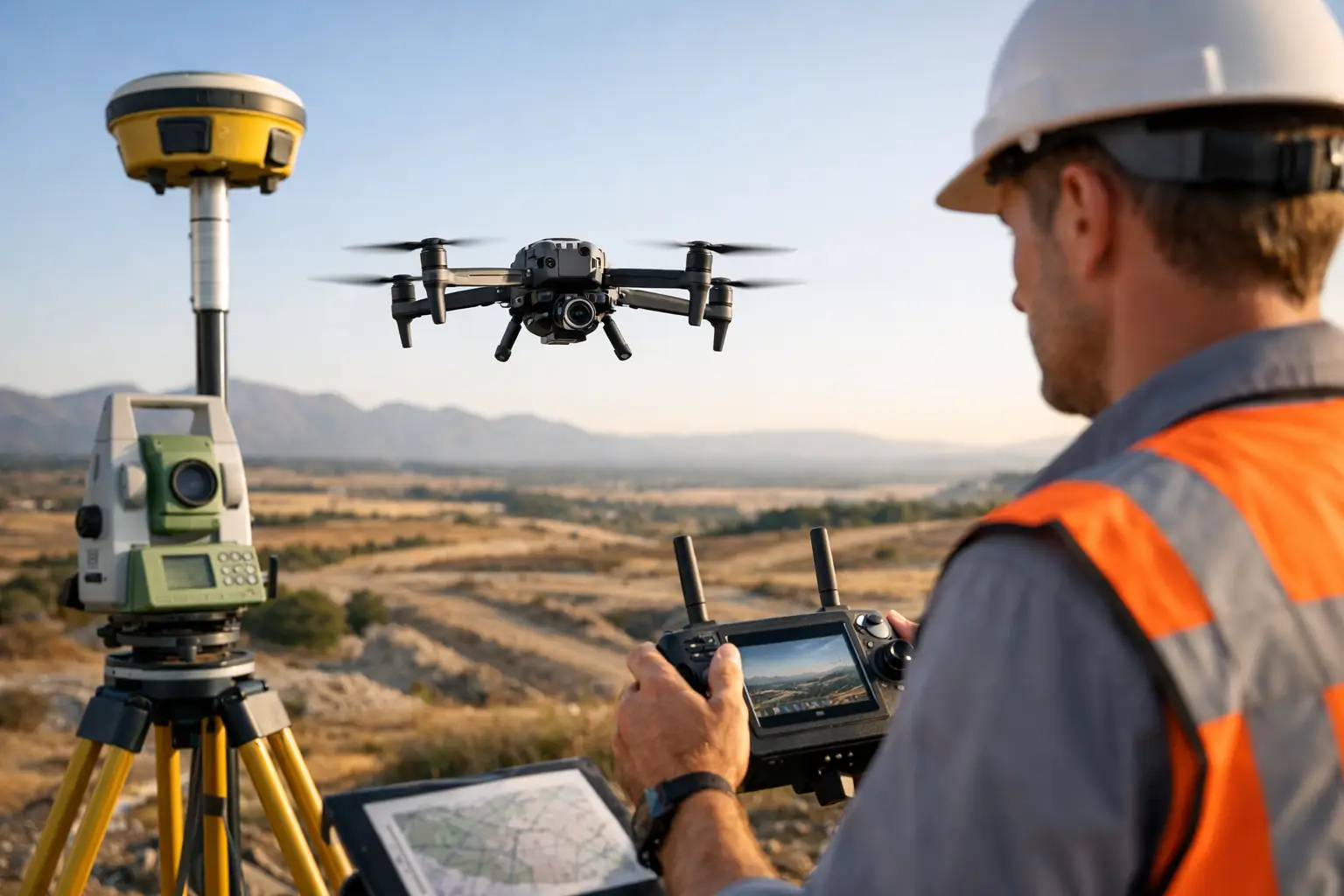
Find the best drone for surveying with clear advice on RTK, cameras, flight planning and DJI platforms for measured mapping and accurate site outputs.
A drone that produces attractive aerial images is not automatically the best drone for surveying. Survey work depends on repeatable data, reliable positioning, suitable sensors and a workflow that holds up when the results are checked against site control. The right choice starts with the deliverable: an orthomosaic for a planning drawing, a stockpile volume, a digital terrain model, a progress record or detailed inspection imagery.
For most professional teams, an enterprise DJI platform with a mapping-focused camera is the sensible starting point. The aircraft matters, but it is only one part of the measuring system. GNSS correction, ground control, mission planning, processing software, batteries and pilot competence all affect the accuracy and efficiency of the finished survey.
What makes the best drone for surveying?
A survey drone should reduce uncertainty rather than simply make data collection quicker. That means selecting an aircraft and sensor combination that can capture consistent imagery across a site, record dependable position data and operate safely in the conditions your work actually involves.
For photogrammetry, camera design is a major consideration. A mechanical shutter is valuable because it helps prevent image distortion while the aircraft is moving. That makes it particularly relevant for mapping corridors, construction sites, quarries and large areas where image overlap and sharp detail are essential. A wide-angle mapping camera is usually the core sensor, while a telephoto camera can add useful context for remote checks and documentation.
Positioning is the next decision. RTK capability can improve the positional quality of captured data by applying corrections during the mission. It is a strong fit for teams that need efficient, repeatable results, but it does not remove the need for a sound survey methodology. Ground control points and independent check points remain valuable where the required accuracy, contractual specification or site conditions demand validation.
Flight endurance and battery management affect productivity more than headline flight-time figures suggest. A system that allows quick battery changes, dependable mission resumption and organised field deployment can save significant time on a working site. Consider wind exposure, take-off locations, terrain, the need for a visual observer and the time required to travel between survey areas.
The right DJI platform for different survey jobs
There is no single aircraft that suits every survey business. The best decision comes from matching the platform to the scale, frequency and technical demands of the work.
DJI Mavic 3 Enterprise for mobile mapping teams
The DJI Mavic 3 Enterprise is a strong choice for surveyors who need a compact, practical aircraft for regular photogrammetry capture. Its portable format is especially useful for topographic checks, construction progress, smaller land parcels, roof surveys and sites where access is limited.
It is the right type of platform when speed of deployment matters and the work is primarily based on visible-light imagery. Pairing it with an RTK solution and a disciplined ground-control workflow can create an efficient mapping setup without committing to a larger airframe.
The trade-off is capacity. Compact enterprise aircraft are highly capable, but they are not the natural answer for every specialist sensor requirement or for large, complex operations that benefit from a more substantial platform. If your work is expanding into detailed corridor mapping, repeated high-volume site capture or LiDAR-led deliverables, assess whether a larger system will be more economical over its working life.
DJI Matrice 4 Enterprise for higher-detail capture
The DJI Matrice 4 Enterprise suits teams that want a more capable enterprise platform while keeping field operations relatively mobile. It is well suited to survey and inspection workflows where a combination of mapping imagery and detailed visual context is useful.
This class of aircraft deserves consideration for engineering consultancies, utilities contractors and survey departments that are moving beyond occasional drone capture. It can support more confident documentation of hard-to-reach features, site conditions and assets while maintaining a survey-focused approach to image collection.
Choose it because its capability supports a genuine workflow need, not simply because it is the newer or larger option. A compact mapping aircraft may still be the better investment if most jobs involve routine orthomosaic capture over modest sites.
DJI Matrice 350 RTK for specialist payload work
The DJI Matrice 350 RTK is designed for organisations that need a heavier-duty enterprise platform and the flexibility to operate compatible specialist payloads. It becomes relevant when payload choice, operational resilience and demanding site conditions are central to the brief.
For survey teams considering LiDAR, thermal work alongside visual data, or more complex inspection requirements, this is the level of platform to assess. It is also a sensible discussion for organisations building an internal drone programme rather than purchasing for occasional projects.
That extra capability brings a larger operational commitment. Transport, batteries, payload management, training and procedures all need to be planned properly. It is an investment in a system, not just an aircraft.
Photogrammetry, LiDAR and the question of accuracy
Photogrammetry creates measured outputs by processing overlapping photographs. It is highly effective for surface models, orthomosaics, volumes and visual site records where sufficient texture and visibility are available. It can be the most cost-effective route for many construction, land and aggregate applications.
LiDAR measures surfaces with laser pulses and can be preferable where vegetation, complex structures or low-texture surfaces make image-based reconstruction less dependable. It is not automatically more accurate in every setting, and it comes with a higher equipment and processing commitment. The value lies in using the right sensor for the surface you need to model.
Accuracy should be discussed in terms of the final deliverable, not a single headline figure. Required tolerances, coordinate reference systems, control methods, terrain, vegetation, camera calibration, flight height and processing settings all influence the result. If the output will inform design, quantities or legal boundaries, set the survey specification before choosing the drone.
Build the workflow before buying the aircraft
The strongest purchase decisions begin with a typical job. Define the area to be captured, the required ground sampling distance, the target output, the coordinate system and the tolerances the client expects. Then establish how you will place and measure control, plan overlap, manage site access and carry out quality checks.
Flight-planning software is essential for consistent coverage. Automated grid missions help maintain overlap and altitude, but pilots still need to assess obstacles, terrain changes, weather and safe launch and recovery areas. Manual flying has a place for visual documentation and inspections, but it is not a substitute for a repeatable mapping mission when measured data is required.
Processing capacity also deserves attention. Large image sets and point clouds require suitable computing hardware, storage and a clear process for archiving raw imagery, flight records and final outputs. A cheaper aircraft can become an expensive choice if it creates bottlenecks in the office or cannot meet the required deliverable.
Do not overlook the support equipment
A survey-ready setup needs more than a drone and controller. Extra batteries, charging provision, a suitable RTK solution, landing protection where appropriate, memory cards, cases and spares all help keep field work moving. Ground control equipment and calibrated measurement methods may be equally important depending on the project.
Service support matters too. A grounded aircraft can delay site work and disrupt a survey programme. Buying from a specialist that can provide pre-purchase advice, repair support and a trade-in route gives the equipment a more practical lifecycle than a one-off marketplace purchase. Drone-Sales can help match enterprise aircraft, accessories and support arrangements to the work your team intends to carry out.
Operate within a professional UK framework
Commercial survey work must be planned around the applicable CAA requirements and the operating category that fits the mission. Registration, operator responsibilities, pilot competency, airspace checks, site risk assessment and appropriate permissions or authorisations are operational essentials, not paperwork to leave until after purchase.
The right drone should support safe, controlled deployment within those requirements. A compact aircraft may make sense where access and setup space are constrained; a larger enterprise platform may be appropriate where the survey scope and operating procedures justify it. Neither changes the pilot’s responsibility to assess each flight properly.
A well-chosen survey drone earns its place by producing data your team can trust, not by carrying the longest specification sheet. Start with the outputs your clients need, build the capture and verification process around them, then choose the platform that makes that process dependable every time.