
Choosing Drone Hire for Surveying Projects
Published
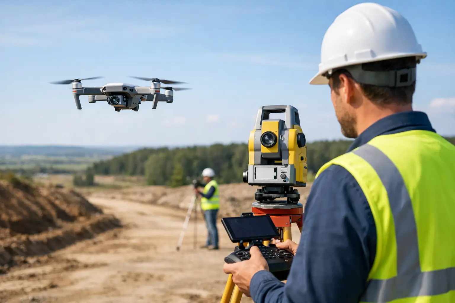
Drone hire for surveying gives UK teams the right aircraft, payload and support for each job, without committing capital to equipment they may rarely use.
A survey deadline does not always justify buying an aircraft, payload, batteries and processing workflow outright. Perhaps a one-off stockpile survey needs current volumetric data, a construction site needs an orthomosaic before the next phase, or a team is assessing whether drone capture belongs in its regular workflow. Drone hire for surveying gives you access to purpose-suited equipment without making the wrong long-term purchase.
The value is not simply having a drone on site. It is having an aircraft, camera or sensor, power solution and support arrangement that can produce usable data for the deliverable your client actually needs. That distinction prevents expensive rework.
Start with the survey deliverable
The right hire package starts at the office, not at the flight line. Before choosing an aircraft, define what will be handed over: a georeferenced orthomosaic, a point cloud, a digital surface model, contours, volume calculations, progress imagery or inspection records. Each output creates different requirements for image quality, overlap, positional accuracy and ground control.
For straightforward visual mapping of a small site, a compact enterprise camera drone may be the sensible choice. It can be quick to deploy and easier to transport between locations. For larger areas or a job where centimetre-level positioning is required, an RTK-capable platform may be more appropriate, particularly when paired with a properly planned control workflow.
It is worth being precise about accuracy. RTK improves the positioning information recorded during capture, but it is not a substitute for sound survey practice. The achievable result depends on the site, mission planning, control points where required, the coordinate system, processing settings and quality assurance. If the data will inform design, quantities or contractual decisions, establish the required tolerance before the equipment is selected.
Mapping, volumes and progress capture
Photogrammetry works by identifying matching features across many overlapping images. It is well suited to clear, textured surfaces such as aggregate piles, exposed ground and building sites, provided the survey is planned around suitable lighting and coverage. Consistent overlap, controlled speed and a camera set-up that avoids motion blur matter more than simply flying higher or collecting more images.
Stockpile and earthworks surveys also need a clear boundary between what is being measured and what is not. Vegetation, standing water, reflective materials and very steep faces can affect photogrammetric results. A hired drone can be an efficient capture tool, but the processing and checking stages remain part of the survey, not an afterthought.
Inspection and hard-to-reach assets
Not every surveying task is a mapping task. Roofs, façades, structures and assets may require detailed oblique imagery rather than a nadir grid. In these cases, camera resolution, zoom capability, the ability to frame a subject safely and controlled flight planning are more relevant than broad-area mapping efficiency.
A hire period is useful for these intermittent requirements because the aircraft can be selected for the job rather than forced to serve every application. The best platform for a tight roof inspection is not necessarily the best platform for a 100-hectare earthworks survey.
Drone hire for surveying: choose the complete system
A drone on its own is rarely a complete surveying solution. Ask what is included in the hire package and whether it aligns with the planned days on site. Batteries, charging equipment, spare propellers, storage media, controllers and transport cases all affect how much useful flying can be completed.
Battery planning deserves particular attention. A stated flight time is not the same as productive survey time. Allow for travel between take-off points, pre-flight checks, weather delays, landing with a sensible reserve and repeat missions. For a larger site, the number of batteries and the charging strategy can make the difference between completing capture in one visit and returning another day.
Payload choice should also be based on evidence, not fashion. A high-resolution RGB camera is often sufficient for visual documentation and photogrammetry. RTK capability can support more efficient georeferencing where the wider workflow is suitable. Thermal payloads may have a role in specific inspection work, but they are not a general replacement for visual survey data. LiDAR can be valuable where vegetation or complex surfaces make photogrammetry less suitable, yet it brings its own processing, classification and verification demands.
If you are unsure which route fits, a consultation before hiring is more cost-effective than trialling unsuitable equipment on a live project. Drone-Sales can help teams match an enterprise drone hire solution to the application, expected output and operational constraints.
Plan the site, not just the flight
Surveying by drone is a field operation with a data capture stage. It needs a site plan. Check access, take-off and landing areas, obstacles, terrain changes, mobile coverage if relevant, lighting, weather and nearby airspace restrictions before the first battery is installed.
The UK operator remains responsible for flying lawfully and safely. Depending on the operation and aircraft, you may need the appropriate CAA registration, pilot competency and operating permissions or authorisations. Rules can change and the details depend on the aircraft, location and intended flight, so check the current CAA requirements and any site-specific restrictions before work begins. A hired aircraft does not transfer those responsibilities to the hire provider.
For controlled survey work, build in time for a pre-flight check, compass and positioning status where relevant, camera settings, mission review and a short verification capture. On site, review sample images before committing to the full mission. Look for sharpness, correct exposure, adequate overlap and gaps caused by shadows, moving machinery or inaccessible areas. Finding a problem while the aircraft is still available is far better than finding it when processing starts back at the office.
Treat data handling as part of the hire decision
Survey teams sometimes focus heavily on the aircraft and leave data management until the end of the day. That is risky. High-resolution imagery, thermal files and LiDAR datasets can consume significant storage, while processing can require capable hardware and specialist software.
Confirm where the original files will be saved, who will back them up, what coordinate reference system the project uses and how the final data will be named and issued. If you are using ground control, record it carefully and make sure it is available to the person processing the imagery. Clear version control is particularly useful where capture, processing and design are handled by different people.
A short pilot project is often the right use of hired equipment. Capture a representative area, process it through your intended software, compare the results against known checks and decide whether the workflow meets the required standard. This is a more reliable basis for a future purchase than choosing on headline specifications alone.
When hiring makes more sense than buying
Hiring is a strong commercial choice when demand is irregular, when a specific sensor is needed for a defined contract, or when a business is testing a new service line. It avoids tying capital into a system that may sit unused between projects, while allowing access to equipment matched to the current brief.
It also gives established operators flexibility during busy periods, temporary equipment downtime or specialist jobs outside their usual capability. However, repeated hires can indicate that ownership deserves serious consideration. If an aircraft is being booked regularly, calculate the full picture: hire frequency, staff availability, training, insurance, maintenance, batteries, software and the value of having the system immediately available.
Buying can be the right answer for a team with a predictable workload and a proven workflow. Hiring first can make that purchase decision far more confident. It lets operators assess field practicality, data quality and client demand before committing to a platform and supporting ecosystem.
Questions to settle before collection or delivery
Before confirming drone hire for surveying, establish the intended outputs, site dates, expected flight days and the experience of the assigned pilot. Confirm what equipment is included, what happens if weather stops work, what support is available during the hire period, and the process for checking the kit on receipt and returning it.
Also be clear on liability, insurance and what must be reported if equipment is damaged or lost. These are practical project controls, not small print to leave until a problem occurs. A professional hire arrangement should make responsibilities understandable from the start.
The strongest hire decision is the one that gives your team enough capability for the job, enough time to collect and verify the data, and a clear route to support if plans change. Get those foundations right, and the aircraft becomes what it should be: a dependable survey instrument, not an expensive experiment.